GeoInformatica ( IF 2 ) Pub Date : 2023-04-11 , DOI: 10.1007/s10707-023-00498-1 Bartłomiej Szypuła
|
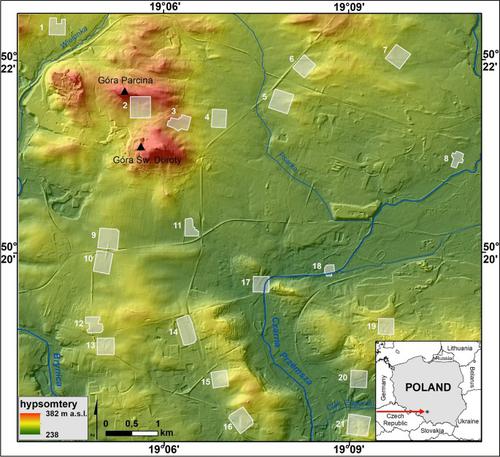
Unmanned aerial vehicles (UAVs) are increasingly used in various environmental research projects and other activities that require accurate topography images. The quality of elevation models derived from UAV measurements varies depending on many variables (e.g. UAV equipment used, terrain conditions, etc.). In order to improve the quality of digital models based on UAV image data, additional GNSS-RTK measurements are usually made at ground control points. The aim of this article is to evaluate the mathematical accuracy of terrain models created without ground control points. The accuracy of the models is considered in two directions: vertical and horizontal. Vertical (elevation) accuracy is calculated based on airborne laser scanning (ALS) data and horizontal (location) accuracy is calculated through comparison with high-resolution orthophotomaps. The average elevation accuracy of all created UAV-based DEMs is found to be 2.7–2.8 m (MAE), 3.1–3.3 m (RMSE), and the average horizontal accuracy is 2.1 m. Despite the low accuracy of the UAV models, the topography is reflected very well in the spatial images. This may be related to the regular and symmetrical distribution of height errors. To improve the accuracy parameters of UAV-based DEMs, it is proposed that they be rapidly georeferenced based on orthophotomaps.
中文翻译:
没有地面控制点的基于无人机的 DEM 的精度
无人驾驶飞行器 (UAV) 越来越多地用于各种需要精确地形图像的环境研究项目和其他活动。源自无人机测量的高程模型的质量因许多变量(例如,使用的无人机设备、地形条件等)而异。为了提高基于无人机图像数据的数字模型的质量,通常在地面控制点进行额外的 GNSS-RTK 测量。本文的目的是评估在没有地面控制点的情况下创建的地形模型的数学准确性。模型的准确性从两个方向考虑:垂直和水平。垂直(高程)精度根据机载激光扫描(ALS)数据计算,水平(位置)精度通过与高分辨率正射影像比较计算。发现所有创建的基于无人机的 DEM 的平均高程精度为 2.7–2.8 m (MAE)、3.1–3.3 m (RMSE),平均水平精度为 2.1 m。尽管无人机模型的精度较低,但地形在空间图像中反映得很好。这可能与高度误差的规则对称分布有关。为了提高基于无人机的 DEM 的精度参数,建议基于正射影像图对它们进行快速地理配准。


 京公网安备 11010802027423号