Wetlands Ecology and Management ( IF 1.8 ) Pub Date : 2023-06-13 , DOI: 10.1007/s11273-023-09932-5 Bennie van der Waal , Suzanne Grenfell , Nicholaus Huchzermeyer , Pippa Schlegel
|
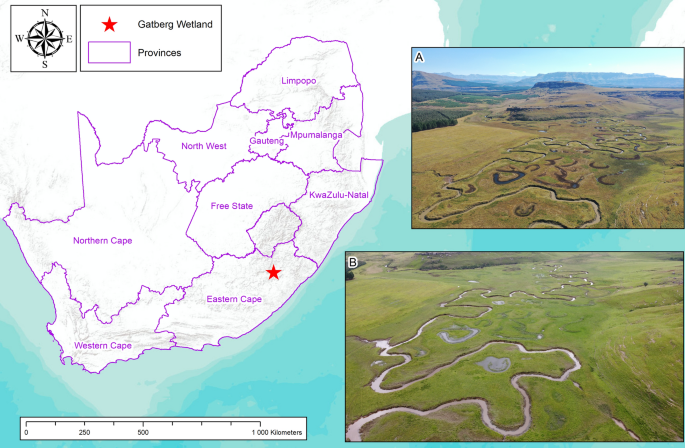
Land surface geomorphology plays an important role in water and sediment dispersal processes in wetlands. For wetland practitioners and researchers to engage with these processes in time and space, they require topographic data in order to derive wetland surface gradient, cross-sectional shape and area, surface and subsurface hydrological connectivity, and hydraulic characteristics. A range of data options, with varying spatial resolutions, are available, ranging from free national and global resources (e.g. contour data and global elevation models) to project-specific high-resolution surveys (e.g. Differential Global Positioning Systems (DGPS), Photogrammetry, Light Detection And Ranging (LiDAR)). Due to the scarcity of high-resolution and high-accuracy data, especially in developing countries, data gathering and processing costs can be significant. This paper presents a commentary on a range of topographic data and processing options for a relatively small (~ 40 ha) floodplain wetland in the Eastern Cape, South Africa. It critically reviews the usefulness and shortfalls of various wetland-related applications ranging from gradient calculations to more detailed hydraulic modelling, and the data resolution required for each application. Free, low-resolution, datasets have a limited representation of geomorphology at this scale due to the relatively low-resolution and large vertical error. Field-based surveys (using survey-grade equipment such as a DGPS) have the benefit of providing accurate terrain results in areas with dense vegetation and surface water, while photogrammetry and LiDAR data are useful to represent the higher resolution morphology across the wetland, despite shortcomings regarding the penetration of dense vegetation and surface water. However, combining DGPS data with LiDAR proves to yield the best model for detailed process modelling for wetlands at the local scale.


 京公网安备 11010802027423号