Irrigation Science ( IF 3 ) Pub Date : 2023-06-30 , DOI: 10.1007/s00271-023-00874-7 Ramesh Dhungel , Ray G. Anderson , Andrew N. French , Todd H. Skaggs , Mazin Saber , Charles A. Sanchez , Elia Scudiero
|
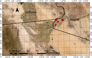
Water shortages in the Western United States will continue to be one of the foremost American agricultural challenges in the coming years. As agriculture is the largest consumer of water in the western US, improvements in irrigation scheduling and modeling are needed to maximize production under limited water. Various satellite-based remote sensing models have been developed to estimate crop water use. However, water balance-based evapotranspiration (ET) models need field-scale irrigation information for initiating the seasonal soil water balance. This initialization has been challenging due to the lack of remotely sensed irrigation event data. In this study, we utilized a recently launched satellite constellation (Planet) with high temporal and spatial resolution data (daily, ~ 3 m) to evaluate if Planet data can facilitate early season irrigation detection. We utilized normalized difference vegetation index (NDVI), moisture index, and individual spectral bands to detect moisture and ultimately infer irrigation. As part of this comparison, a hybrid two-source energy and water balance model BAITSSS (Backward-Averaged Iterative Two-Source Surface temperature and energy balance Solution) was used to estimate ET with Planet-based vegetation indices and irrigation information. We also compared the results to eddy covariance (EC) located at lettuce fields in Yuma, Arizona in the lower Colorado River basin between 2016 and 2020. Overall, the results indicated that Planet’s data helped to establish the field-scale onset of irrigation, which assisted to initiate soil water balance in the BAITSSS model, thus ultimately improving ET. Further, these results should support the development of near-real-time landscape-scale ET and should be highly beneficial to agricultural communities for sub-field-scale effective water management.
中文翻译:
基于Planet卫星的科罗拉多河下游盆地水能平衡算法的冬季蔬菜早季灌溉检测和蒸散建模
美国西部的水资源短缺将继续成为未来几年美国农业面临的最重要挑战之一。由于农业是美国西部最大的水资源消耗者,因此需要改进灌溉调度和建模,以在有限的水资源下最大限度地提高产量。已经开发了各种基于卫星的遥感模型来估计作物用水量。然而,基于水平衡的蒸散量(ET)模型需要田间规模的灌溉信息来启动季节性土壤水平衡。由于缺乏遥感灌溉事件数据,这种初始化一直具有挑战性。在这项研究中,我们利用了最近发射的卫星星座(Planet),具有高时间和空间分辨率数据(每日、~ 3 m)以评估行星数据是否可以促进早期灌溉检测。我们利用归一化植被指数 (NDVI)、湿度指数和各个光谱带来检测湿度并最终推断灌溉情况。作为比较的一部分,混合双源能源和水平衡模型 BAITSSS(向后平均迭代双源地表温度和能量平衡解决方案)用于通过基于行星的植被指数和灌溉信息来估计蒸散量。我们还将结果与 2016 年至 2020 年科罗拉多河下游流域亚利桑那州尤马生菜田的涡度协方差 (EC) 进行了比较。总体而言,结果表明 Planet 的数据有助于确定田间规模的灌溉起始时间,协助启动 BAITSSS 模型中的土壤水平衡,从而最终改善 ET。此外,这些结果应支持近实时景观尺度蒸散技术的发展,并对农业社区进行子田尺度有效水管理非常有利。


 京公网安备 11010802027423号