MAPAN ( IF 1 ) Pub Date : 2023-09-07 , DOI: 10.1007/s12647-023-00683-5 Srinithisathian Sathian , J. Brema
|
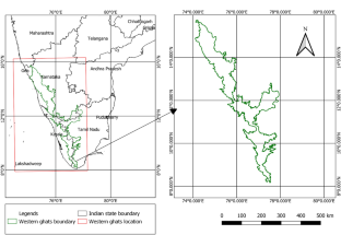
Coronavirus disease (COVID-19) has changed the living environment in various aspects just like any other disaster. The goal of this study was to use time series remote sensing data to analyze vegetative cover change in the Western ghats of south India from January 2018 to June 2021 (pre & post covid scenario). In this context, biodiversity in terms of Normalized Differential Vegetation Index (NDVI) has been investigated in relation to variations in anthropogenic activity levels before and after the Covid-19 period. A spatio-temporal analysis of NDVI, LULC change, rainfall and AOD in relation to lockdown due to Covid-19 was conducted in this study. The study demonstrates the adaptability of remote sensing techniques and GIS for monitoring the changes in biodiversity in a more precise and cost-effective way, which is ideal for conservation planning and prioritization. Also, this study investigates the relationship between rainfall, AOD and NDVI during the study period. The results show that some parts of the Western Ghats which lies in Chamrajnagar of Karnataka, Erode and Dharmapuri of Tamil Nadu experienced significant vegetative cover change during the study period. It is also been inferred that there are changes in vegetative cover along the transect points situated in Shimoga of Karnataka, Palakkad and Idukki of Kerala due to the outbreak of forest fires. The restriction during the Covid-19 lock down has minimized the disturbance in the Ghats region which echoed in the increase in vegetative cover as well as areal extent of water bodies during post corona period (2021). The effect of increase in rainfall has reflected in the reduction in concentration of aerosol due to wet scavenging effect.
中文翻译:
使用 Sentinel-2A 图像评估印度南部西高止山脉 Covid-19 前后的植被动态
与其他灾难一样,冠状病毒病(COVID-19)从各个方面改变了生活环境。本研究的目标是利用时间序列遥感数据分析 2018 年 1 月至 2021 年 6 月(新冠疫情前后情景)印度南部西高止山脉的植被覆盖变化。在这种背景下,我们对归一化植被指数 (NDVI) 方面的生物多样性与 Covid-19 时期前后人类活动水平变化的关系进行了调查。本研究对 NDVI、LULC 变化、降雨量和 AOD 与 Covid-19 封锁相关的时空分析进行了分析。该研究证明了遥感技术和地理信息系统以更精确和更具成本效益的方式监测生物多样性变化的适应性,这是保护规划和优先排序的理想选择。此外,本研究还调查了研究期间降雨量、AOD 和 NDVI 之间的关系。结果表明,位于卡纳塔克邦查姆拉吉讷格尔、泰米尔纳德邦埃罗德和达尔马普里的西高止山脉部分地区在研究期间经历了显着的植被覆盖变化。据推测,由于森林火灾的爆发,卡纳塔克邦希莫加、喀拉拉邦帕拉卡德和伊杜基等地的植被覆盖也发生了变化。Covid-19 封锁期间的限制最大限度地减少了对高止山脉地区的干扰,这与后电晕时期(2021 年)植被覆盖率以及水体面积的增加相呼应。


 京公网安备 11010802027423号