Geography and Natural Resources Pub Date : 2023-09-21 , DOI: 10.1134/s1875372823020105 M. Yu. Opekunova , I. N. Bilichenko , A. V. Bardash , S. A. Sedykh
|
Abstract
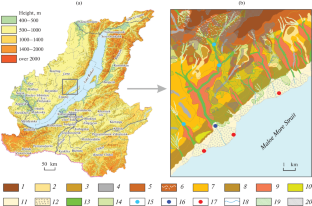
A morphometric analysis is made of the relief for the mountainous territory in Western Cisbaikalia: the Primorskii Range, the landscapes of which have been transformed for a long time under the influence of the pyrogenic factor. Under such conditions, it becomes relevant to determine the relationships between the geomorphological conditions of the territory and the distribution of postpyrogenic landscapes, as well as the possibility of using the results in landscape mapping. The basis for maps of surface curvature is provided by a digital elevation model based on ALOS radiometer data with a resolution of 30 m. Using geoinformation analysis, maps of the steepness and exposure of slopes and horizontal and vertical curvature are obtained and the statistical coefficients of these indicators for the study area are determined. To determine the degree of influence of geomorphological conditions on the distribution of postpyrogenic landscapes, a geomorphological map is compiled, a typification of the relief is carried out according to the altitudinal layers, and a correlation with corresponding types of locations is determined. At this stage of research, the following connections are revealed between the geomorphological heterogeneity of the local relief and the nature of the spread of fire: in some cases, river valleys become barriers to the spread of fire (their summits are usually not affected by fire). Another option for barriers are the ridges located across slopes; thus, the orientation of orographic relief elements can be designated as a limiting factor in the spread of fires. The prevailing southeastward exposure of the macroslope of the Primorskii Range, which coincided with the northwestward direction of the main air transport, becomes an intensifying factor in the spread.
中文翻译:
地势对滨海边疆区(西斯贝卡利亚)地球系统热源扰动的影响
摘要
对西斯贝卡利亚西部山区的地貌进行了形态测量分析:滨海边疆区,该地区的地貌在热成因素的影响下已经发生了很长一段时间的变化。在这种条件下,确定该地区的地貌条件与火成后景观分布之间的关系以及将结果用于景观制图的可能性就变得至关重要。地表曲率图的基础是基于分辨率为 30 m 的 ALOS 辐射计数据的数字高程模型。利用地理信息分析,获得斜坡的陡度和暴露度以及水平和垂直曲率的地图,并确定研究区域这些指标的统计系数。为确定地貌条件对火成后景观分布的影响程度,编制地貌图,按海拔层次对地貌进行典型化,并确定与相应类型地点的相关性。在这一阶段的研究中,揭示了当地地形的地貌异质性与火灾蔓延的性质之间的以下联系:在某些情况下,河谷成为火灾蔓延的障碍(其山顶通常不会受到火灾的影响) )。屏障的另一种选择是横跨斜坡的山脊;因此,地形起伏要素的方向可以被指定为火势蔓延的限制因素。普里莫尔斯基山脉的大斜坡普遍向东南暴露,


 京公网安备 11010802027423号