Paddy and Water Environment ( IF 2.2 ) Pub Date : 2023-09-26 , DOI: 10.1007/s10333-023-00953-7 Pandiya Rajhan Govindasamy Kannan , Vijay Aravinth Radhika Panchabikesan , Swetha Kamaraj , Ravikumar Govindasamy
|
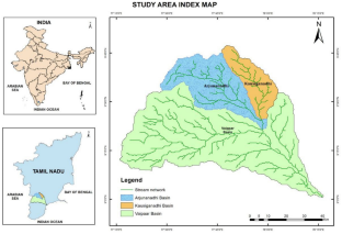
Drought is a serious natural hazard caused by a lack of precipitation in relation to what is expected or normal, which, if prolonged over a season or longer time, is insufficient to fulfil human activity demands. It is a seasonal, localised natural occurrence of the climate. Droughts are thus primarily brought on by precipitation deficits brought on by regional and temporal natural climate variability. Droughts cannot be stopped, but their effects on people and plants can be lessened by being well-prepared for their likely occurrence. India experienced a 22% total rainfall deficiency in 2009, which reduced food grain production by 16 million tonnes. The drought that affected a considerable portion of the nation in 2014, 2015, and 2016 caused significant problems for the affected populace since it devastated important agricultural regions of the nation. The Arjunanadhi sub-basin typically experiences heat and drought every five years, according to the project report for Irrigated Agriculture Modernization and Water-Bodies Restoration and Management (IAMWARM). The purpose of this research is to pinpoint the variable that causes drought in the Vaippar river's sub-basins of Arjunanadhi and Koushiganadhi. The Standardized Precipitation Index (SPI) for meteorological drought, the Water Requirement Satisfaction Index (WRSI) tool for agricultural drought, and the Herbst method for hydrological drought are used to establish a link between crop production and crop area. Meteorological, hydrological, and agricultural drought are assessed using a variety of methods, including GIS, Multivariate Analysis, and the use of different indicators. Based on the return period of drought calculated using SPI for the Arjunanadhi and Koushiganadhi sub-basins, the overall drought happens once every three to four years. When the land is used for paddy and sugarcane, the Arjunanadhi and Koushiganadhi sub-basins' Water Requirement Satisfaction Index is extremely susceptible to drought. The stream flow statistics from the reservoirs at Anaikuttam and Kullursandai indicate that the Arjunanadhi and Koushiganadhi were impacted by severe and extreme drought, according to the hydrological drought evaluation's negative indicators. As per multivariate analysis, rainfall is the factor most likely to influence the probability of drought since the independent variable crop production has a better correlation with the SPI indices and crop area.
中文翻译:
使用多变量指数评估印度泰米尔纳德邦 Vaippar 河流域子流域的干旱
干旱是一种严重的自然灾害,是由于降水量低于预期或正常水平而造成的,如果降水持续一个季节或更长时间,就不足以满足人类活动的需求。它是一种季节性的、局部的自然气候现象。因此,干旱主要是由区域和时间自然气候变化引起的降水不足引起的。干旱无法阻止,但可以通过为可能发生的干旱做好充分准备来减轻其对人类和植物的影响。2009 年,印度的降雨总量减少了 22%,导致粮食产量减少了 1600 万吨。2014年、2015年影响全国大部分地区的干旱,2016 年给受影响民众带来了严重问题,因为它摧毁了该国重要的农业地区。根据灌溉农业现代化和水体恢复与管理 (IAMWARM) 项目报告,Arjunanadhi 子流域通常每五年经历一次高温和干旱。这项研究的目的是查明导致 Vaippar 河 Arjunanadhi 和 Koushiganadhi 子流域干旱的变量。气象干旱的标准化降水指数(SPI)、农业干旱的需水满足指数(WRSI)工具和水文干旱的赫布斯特方法用于建立作物产量和作物面积之间的联系。使用多种方法评估气象、水文和农业干旱,包括GIS、多元分析以及不同指标的使用。根据SPI对Arjunanadhi和Koushiganadhi子流域干旱重现期的计算,整体干旱每三到四年发生一次。当土地用于种植水稻和甘蔗时,Arjunanadhi 和 Koushiganadhi 子流域的需水满足指数极易受到干旱的影响。根据水文干旱评价的负面指标,Anaikuttam 和 Kullursandai 水库的流量统计表明,Arjunanadhi 和 Koushiganadhi 受到严重和极端干旱的影响。根据多变量分析,


 京公网安备 11010802027423号