GPS Solutions ( IF 4.9 ) Pub Date : 2023-12-27 , DOI: 10.1007/s10291-023-01591-6 Chao Chen , Rong Zou , Zhiwei Fang , Jiaming Cao , Qi Wang
|
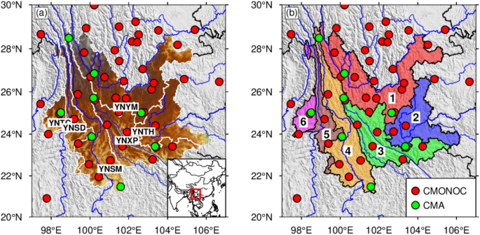
The use of the global navigation satellite system (GNSS) for monitoring changes in terrestrial water storage (TWS) is growing. However, the density of GNSS stations is sparse in most areas, and the widely used Green’s function (GF) method cannot provide a satisfactory resolution for inversion problems. As the Slepian basis function (SBF) method has been successfully used for gravity inversions, GNSS geodesists have recently applied the SBF method to GNSS displacements. However, the evaluation of TWS differences inferred from GNSS using the SBF and the GF has been rarely assessed. In this study, we use both the GF and the SBF methods to investigate the TWS in Yunnan by using more than ten years (2010–2021) of GNSS observations. We observe a remarkable consistency between the two inversion methods employed for GNSS data, as well as a strong agreement with equivalent water heights (EWH) inferred from the Gravity Recovery and Climate Experiment (GRACE) and GRACE Follow-On (GFO), hydrological model (GLDAS-NOAH), and precipitation data, despite variations in the amplitude. Furthermore, affected by monsoon climate and topography, Yunnan is prone to drought. We analyze the main nine drought events, evaluate the connection between GNSS-inverted TWS during 2010–2021, and find that almost all droughts in Yunnan occurred during the "trough period" within the GNSS-DSI.


 京公网安备 11010802027423号