International Journal of Disaster Risk Science ( IF 4 ) Pub Date : 2023-12-27 , DOI: 10.1007/s13753-023-00526-6 Haobin Xia , Jianjun Wu , Jiaqi Yao , Hong Zhu , Adu Gong , Jianhua Yang , Liuru Hu , Fan Mo
|
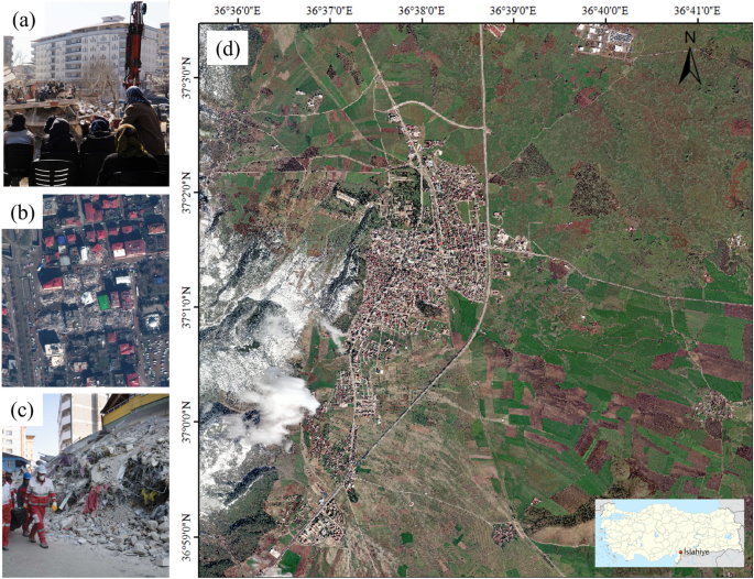
Rapid building damage assessment following an earthquake is important for humanitarian relief and disaster emergency responses. In February 2023, two magnitude-7.8 earthquakes struck Turkey in quick succession, impacting over 30 major cities across nearly 300 km. A quick and comprehensive understanding of the distribution of building damage is essential for efficiently deploying rescue forces during critical rescue periods. This article presents the training of a two-stage convolutional neural network called BDANet that integrated image features captured before and after the disaster to evaluate the extent of building damage in Islahiye. Based on high-resolution remote sensing data from WorldView2, BDANet used pre-disaster imagery to extract building outlines; the image features before and after the disaster were then combined to conduct building damage assessment. We optimized these results to improve the accuracy of building edges and analyzed the damage to each building, and used population distribution information to estimate the population count and urgency of rescue at different disaster levels. The results indicate that the building area in the Islahiye region was 156.92 ha, with an affected area of 26.60 ha. Severely damaged buildings accounted for 15.67% of the total building area in the affected areas. WorldPop population distribution data indicated approximately 253, 297, and 1,246 people in the collapsed, severely damaged, and lightly damaged areas, respectively. Accuracy verification showed that the BDANet model exhibited good performance in handling high-resolution images and can be used to directly assess building damage and provide rapid information for rescue operations in future disasters using model weights.
中文翻译:
土耳其地震中使用超高分辨率遥感图像进行建筑损坏评估的深度学习应用
地震后快速评估建筑受损情况对于人道主义救援和灾难应急响应非常重要。2023 年 2 月,土耳其连续发生两次 7.8 级地震,影响了 30 多个主要城市,面积近 300 公里。快速、全面地了解建筑物受损的分布情况对于在关键救援时期高效部署救援力量至关重要。本文介绍了名为 BDANet 的两阶段卷积神经网络的训练,该网络集成了灾难前后捕获的图像特征,以评估 Islahiye 的建筑物损坏程度。基于 WorldView2 的高分辨率遥感数据,BDANet 使用灾前图像提取建筑物轮廓;然后结合灾难前后的图像特征来进行建筑物损坏评估。我们对这些结果进行了优化,以提高建筑物边缘的准确性,并分析了每栋建筑物的受损情况,并利用人口分布信息来估计不同灾害级别的人口数量和救援紧急程度。结果表明,Islahiye地区的建筑面积为156.92公顷,受影响面积为26.60公顷。受损严重的建筑物占受影响地区总建筑面积的15.67%。WorldPop 人口分布数据显示,塌陷区、严重受损区和轻度受损区分别约有 253 人、297 人和 1,246 人。精度验证表明,BDANet模型在处理高分辨率图像方面表现出良好的性能,可用于直接评估建筑物损坏情况,并利用模型权重为未来灾难救援行动提供快速信息。


 京公网安备 11010802027423号