GPS Solutions ( IF 4.9 ) Pub Date : 2024-01-08 , DOI: 10.1007/s10291-023-01599-y Liu Yang , Zengke Li , Yu Tian , Jingxiang Gao , Jianqing Fan
|
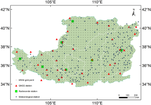
Water vapor is one of the important atmospheric components of atmospheric circulation and dynamics, and its accurate and spatiotemporally continuous estimation is important for understanding the water vapor conveying mechanism and the hydrologic cycle. We proposed a new fusion strategy where the precipitable water vapor (PWV) derived from global positioning system (GPS) and surface meteorological observations was introduced. Compared to previous methods using radiosonde data, remote sensing satellite water vapor products, and atmospheric reanalysis products, our fusion strategy adopted the PWV calculated from the surface meteorological observations for the first time. It also has a potential near real-time capability for high temporal resolution water vapor monitoring in areas with sparse GPS station distribution (the average distance exceeds 100 km) such as mountainous areas, basins, and plateaus. Based on PWV data derived from 35 GPS and 237 surface meteorological stations, we established hourly fusion models through simplified spherical cap harmonic analysis for the Loess Plateau of China. The validation results show that when PWV data derived from ERA5 reanalysis and radiosonde in 2020 were used as reference values, the mean root-mean-square (RMS) of the PWV derived from fusion models based on GPS and surface meteorological observations were 3.87 and 2.51 mm, respectively. Compared to the strategy using only GPS observations, the accuracy of the model PWV was improved by approximately 60.4% by fusing GPS and surface meteorological PWV data when the ERA5 data is used as a references value. Compared to the strategy using only surface meteorological observations, the accuracy of the model PWV was respectively improved by approximately 16.0% and 32.7% after fusing GPS-derived PWV data when the ERA5 and radiosonde data are used as reference values. Therefore, through our fusion strategy, the accuracy of GPS PWV data and the spatial resolution of surface meteorological PWV data could be complementary in regard to water vapor field estimation. This study shows that the fusion strategy has a potential application prospect in near real-time water vapor monitoring for numerical weather predictions (NWP) data assimilation and short-term rainfall forecasting.


 京公网安备 11010802027423号