Journal of the Indian Society of Remote Sensing ( IF 2.5 ) Pub Date : 2024-01-31 , DOI: 10.1007/s12524-024-01825-1 S. K. Ray , V. R. Desai
|
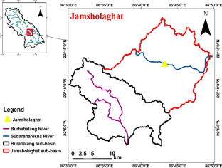
Availability of fresh water resources in the world is one of the most important concerns for the survival of mankind. In order to meet the future demand, available fresh water resources needs to be used sustainably. Suitable soil and water conservation measures to be taken timely to avoid the consequences such as shortage of fresh water resources in near future. For this purpose, identification of suitable sites are required where excess rain water is available and surroundings are supportive for amplifying the infiltration rate. This study focuses on selecting the sites those are suitable for water harvesting structure for Jamsholaghat sub-basin. This is done by overlaying land use and land cover map, drainage density map, runoff map, slope map, lithology map, curve number map, soil depth map, hydrological soil group map and lineament density map in the ArcGIS software by considering ranks assigned to each thematic map using Analytical Hierarchy Process. For selecting the ideal location of check dams and subsurface dykes, the criteria assigned are given by Integrated Mission for Sustainable Development. For check dams, it was found that 17%, 31%, 37% and 15% of the study areas are having low, moderate, high and very high suitability, respectively. For subsurface dykes, it was found that 10%, 27%, 38% and 25% of the study areas are having low, moderate, high and very high suitability, respectively.
中文翻译:
利用 GIS 和多标准决策分析确定 Jamsholaghat 子流域适合集水结构的地点
世界淡水资源的可用性是人类生存最重要的问题之一。为了满足未来的需求,需要可持续地利用现有的淡水资源。及时采取适当的水土保持措施,避免近期出现淡水资源短缺等后果。为此,需要确定有多余雨水且周围环境有利于提高渗透率的合适地点。本研究的重点是选择适合 Jamsholaghat 子流域集水结构的地点。这是通过在ArcGIS软件中叠加土地利用和土地覆盖图、排水密度图、径流图、坡度图、岩性图、曲线数图、土壤深度图、水文土壤组图和线理密度图来完成的,并考虑分配给的等级每个专题地图都使用层次分析法。为了选择淤地坝和地下堤坝的理想位置,可持续发展综合使命给出了指定的标准。对于淤地坝,研究发现分别有 17%、31%、37% 和 15% 的研究区域具有低、中、高和非常高的适宜性。对于地下堤坝,发现分别有 10%、27%、38% 和 25% 的研究区域具有低、中、高和非常高的适宜性。


 京公网安备 11010802027423号