Izvestiya, Atmospheric and Oceanic Physics ( IF 0.7 ) Pub Date : 2024-01-31 , DOI: 10.1134/s0001433823090086 P. G. Ilyushina , A. N. Shikhov , O. M. Makarieva
|
Abstract
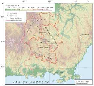
Gold mining at ore and alluvial deposits substantially negatively impacts the natural environment, in particular, by land degradation and the contamination of watercourses with suspended solids. In this study, we consider a methodology for identifying and mapping the negative impact of gold mining enterprises on the natural environment based on a long-term series of free-available Landsat and Sentinel-2 satellite images. This study is carried out using the example of Tenkinsky, Susumansky, and Yagodninsky districts in Magadan oblast, where the largest gold deposits are located. Identifying features of active mining areas, as well as abandoned ones (on which vegetation began to recover), have been found in satellite images. Based on the expert interpretation of the images and NDVI analysis, it is found that about 2% of the study area has been affected by gold mining. The processes of vegetation recovery are identified only on 10% of the degraded lands. In the Tenkinsky district, the area of disturbed lands for the period 2001–2021 increased more than seven times, which is associated with a substantial increase in gold mining. Using the C2RCC processor (module of the SNAP software package), the content of suspended solids in the water of the most impacted rivers, the Berelekh, Ayan-Yuryakh, and Kolyma, has been estimated in comparison with natural values (typical for noncontaminated water). We have found that the main source of suspended matter in the rivers is the alluvial gold deposits located in the floodplain of the Berelekh River. At the same time, the seasonal variability of water contamination is determined by the hydrological situation. In particular, water turbidity decreases during low water periods and increases during high-flow periods.
中文翻译:
金矿企业对冰石带自然环境负面影响的卫星测绘(以马加丹州为例)
摘要
矿石和冲积矿床的金矿开采对自然环境产生重大负面影响,特别是土地退化和悬浮固体污染水道。在这项研究中,我们考虑了一种基于一系列长期免费的 Landsat 和 Sentinel-2 卫星图像来识别和绘制金矿企业对自然环境的负面影响的方法。本研究以马加丹州最大的金矿所在地 Tenkinsky、Susumansky 和 Yagodninsky 地区为例进行。在卫星图像中发现了活跃矿区以及废弃矿区(植被开始恢复)的特征。根据专家对图像的解读和NDVI分析,发现研究区域约2%受到金矿开采的影响。仅在 10% 的退化土地上发现了植被恢复过程。在 Tenkinsky 地区,2001 年至 2021 年期间受干扰土地面积增加了七倍多,这与金矿开采量大幅增加有关。使用 C2RCC 处理器(SNAP 软件包的模块),与自然值(非污染水体的典型值)相比,估算了受影响最严重的河流(Berelekh、Ayan-Yuryakh 和 Kolyma)水中的悬浮固体含量。 )。我们发现河流中悬浮物的主要来源是位于别列赫河漫滩的冲积金矿床。同时,水污染的季节变化是由水文状况决定的。特别是,水的浊度在低水位期间降低,在高水位期间增加。


 京公网安备 11010802027423号