Theoretical and Applied Climatology ( IF 3.4 ) Pub Date : 2024-02-16 , DOI: 10.1007/s00704-024-04874-1 Biswarup Rana , Jatisankar Bandyopadhyay , Bijay Halder
|
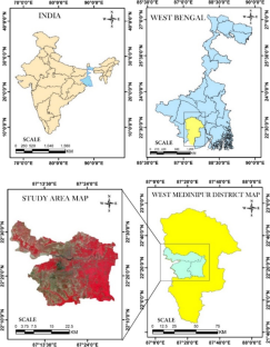
Urbanization is triggering the expansion in an unplanned and unrestricted manner, growth of outward expansion for some areas. One such important environmental and ecological hazard in recent decades is urban heat island (UHI) and urban thermal field variation index (UTFVI). Studies employing temporal satellite imagery from 1991 to 2021 focused on the appraisal of spatiotemporal patterns of urbanization and UHI in West Bengal’s mid-sized cities (Medinipur and Kharagpur city). This study examines competencies of remote sensing (RS) and GIS procedures in empathetic heat effects and urban thermal conditions using Landsat datasets and GEE cloud software-based time-consuming conventional method. The change detection analysis revealed that built-up lands developed since 7.88–26.94% (1991–2021). The UHI’s highest value in 1991 is 4.57 and in 2021 it increased by 6.87%. The highest 0.34% UTFVI value is found in the year 1991, but in 2021, the highest value was shown at 0.35% in this study area. The mean NDVI value increased from 1991 (0.29%) to 2021 (0.44%). The land surface temperature (LST) maps have been prepared using Landsat 5 and Landsat 8 surface reflectance datasets. Anthropogenic-related ecological changes in urbanized areas are concerning these days since they have the potential to negatively impact both the environment and human health. The investigation has shown that while LULC alterations were sufficiently large, unplanned changes to it can have a detrimental effect on the environment. Investigation established an operative systematic methods application to measure urbanization appearances and urban thermal conditions in Medinipur and Kharagpur city.
中文翻译:
利用遥感和机器学习方法研究城市扩张与城市热岛之间的关系
城镇化引发无计划、无限制的扩张,部分地区向外扩张增多。近几十年来,此类重要的环境和生态危害之一是城市热岛(UHI)和城市热场变化指数(UTFVI)。使用 1991 年至 2021 年时间卫星图像的研究重点是评估西孟加拉邦中型城市(梅迪尼布尔和克勒格布尔市)的城市化和城市热岛倡议的时空模式。本研究使用 Landsat 数据集和基于 GEE 云软件的耗时传统方法,检验遥感 (RS) 和 GIS 程序在移情热效应和城市热条件方面的能力。变化检测分析显示,建设用地开发率为 7.88%–26.94%(1991 年至 2021 年)。 1991年城市热岛指数最高值为4.57,2021年增长了6.87%。 UTFVI 最高值出现在 1991 年,但在 2021 年,该研究区域的最高值达到 0.35%。 NDVI 平均值从 1991 年(0.29%)增加到 2021 年(0.44%)。陆地表面温度 (LST) 地图是使用 Landsat 5 和 Landsat 8 表面反射率数据集绘制的。如今,城市化地区与人为相关的生态变化令人担忧,因为它们有可能对环境和人类健康产生负面影响。调查表明,虽然土地利用和土地利用变化足够大,但计划外的变化可能会对环境产生不利影响。调查建立了一个可操作的系统方法应用来测量梅迪尼普尔和克勒格普尔市的城市化外观和城市热状况。


 京公网安备 11010802027423号