Hydrogeology Journal ( IF 2.8 ) Pub Date : 2024-02-21 , DOI: 10.1007/s10040-024-02776-0 Arifin , Mohammad Shamsudduha , Agus M. Ramdhan , Sena W. Reksalegora , Richard G. Taylor
|
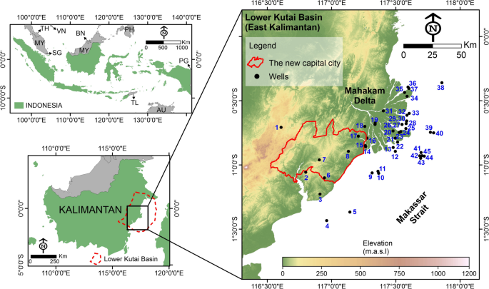
Groundwater at depths exceeding 500 m can be an important source of freshwater. However, the characteristics of deep groundwater in many regions of the world, including Indonesia’s sedimentary basins, remain vaguely defined. This study investigates the pressure regimes, hydraulic head distributions, salinity, and hydrochemical facies of deep groundwater using available evidence from oil and gas exploration wells in the Lower Kutai Basin of Indonesia. Pressure measurements and wireline log data reveal three pressure regimes within the basin: hydrostatic, overpressure, and underpressure. The top of the overpressure varies, from close to the surface onshore to depths of ~4.5 and ~3.8 km in the Mahakam Delta and offshore, respectively. Computed hydraulic heads at the top of the overpressure range from ~191 m above sea level onshore to ~71 m below sea level offshore, and are indicative of regional groundwater flow. The observed salinity of deep groundwater within the basin indicates predominantly brackish or saline conditions. Fresh (total dissolved solids < 1 g/L) groundwater to a depth of ~2 km is found at a small minority of wells onshore and in the delta; no fresh groundwater is found offshore. Four hydrochemical facies are observed: Na+/Cl–, Ca2+/Cl–, Na+/HCO3–, and Na+–Ca2+/HCO3–. This study indicates that deep fresh groundwater in the Lower Kutai Basin is of localized occurrence. Recharge from meteoric water may replenish deep fresh groundwater within the hydrostatic zone and sustain water supplies, whether brackish or fresh. Water produced from clay diagenesis is also cited as a possible process of freshening deep groundwater.
中文翻译:
利用印度尼西亚下库台盆地石油和天然气勘探井的证据表征深层地下水
深度超过500 m的地下水可成为重要的淡水来源。然而,包括印度尼西亚沉积盆地在内的世界许多地区深层地下水的特征仍然不明确。本研究利用印度尼西亚下库泰盆地石油和天然气勘探井的现有证据,研究了深层地下水的压力状况、水头分布、盐度和水化学相。压力测量和电缆测井数据揭示了盆地内的三种压力状态:静水压、超压和欠压。超压的顶部各不相同,从接近陆上地表到马哈卡姆三角洲和近海的约 4.5 公里和约 3.8 公里的深度。计算得出的超压顶部水头范围从陆上海平面以上约 191 m 到离岸海平面以下约 71 m,并且表明了区域地下水流量。观察到的盆地内深层地下水的盐度表明主要是咸水或咸水条件。在少数陆上和三角洲的井中发现了约 2 公里深度的新鲜地下水(总溶解固体 < 1 克/升);近海未发现淡水。观察到四种水化学相:Na + /Cl –、Ca 2+ /Cl –、Na + /HCO 3 –和Na + –Ca 2+ /HCO 3 –。这项研究表明下库台盆地深层淡水地下水是局部存在的。大气水的补给可以补充静水区内的深层淡水并维持水供应,无论是咸水还是淡水。粘土成岩作用产生的水也被认为是净化深层地下水的可能过程。


 京公网安备 11010802027423号