Theoretical and Applied Climatology ( IF 3.4 ) Pub Date : 2024-03-04 , DOI: 10.1007/s00704-024-04909-7 Pedro S. Blanco , Moira E. Doyle
|
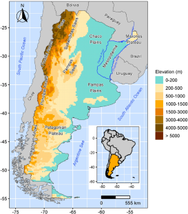
This paper analyzes spatial and temporal changes of aridity in Argentina (1961–2022). The aridity degree, using Climatic Research Unit (CRU) monthly data, was defined through six climate types classified by De Martonne Aridity Index (DMI). Argentina presents a very arid, arid and semiarid region that extends from Puna to Patagonia, alongside two humid and very humid regions: one located in the Chaco-Pampas Plains and Mesopotamia, and another in the Patagonian Andes. Between these regions, there are subhumid areas with marked aridity variations. These structures persist over time, but advances or setbacks were observed in their bordering areas, with significant changes in the Andes (leading to more arid conditions) and the southwestern Pampas Plains (leading to more humid conditions) during the historical period. The contribution of temperature and precipitation changes to these DMI changes was quantified, indicating that precipitation modulated the DMI spatial changes, while temperature intensified or weakened the change magnitudes. The extension variations of the arid and semiarid regions in Argentina were related to three climate variability modes (El Niño – Southern Oscillation [ENSO], Pacific Decadal Oscillation [PDO] and South Atlantic Ocean Dipole [SAOD]). Significant correlations were found with PDO (r < 0) and SAOD (r > 0), which indicate that an increase in the area occupied by arid and semiarid climates are associated with PDO negative phase or SAOD positive phase. Moreover, when these phases occur simultaneously, the expansion of arid and semiarid regions is larger than under the action of an individual forcing.
中文翻译:
阿根廷干旱时空变化及其与海洋-大气遥相关模式的关系
本文分析了阿根廷干旱度的时空变化(1961-2022)。干旱程度使用气候研究单位(CRU)月度数据,通过德马通干旱指数(DMI)分类的六种气候类型来定义。阿根廷有一个从普纳延伸到巴塔哥尼亚的非常干旱、干旱和半干旱地区,还有两个潮湿和非常潮湿的地区:一个位于查科潘帕斯平原和美索不达米亚,另一个位于巴塔哥尼亚安第斯山脉。在这些地区之间,存在着干旱变化明显的半湿润地区。这些结构随着时间的推移持续存在,但在其边界地区观察到了进步或倒退,在历史时期安第斯山脉(导致更加干旱的条件)和西南潘帕斯平原(导致更加潮湿的条件)发生了显着变化。温度和降水变化对 DMI 变化的贡献被量化,表明降水调节了 DMI 空间变化,而温度则加剧或减弱了变化幅度。阿根廷干旱和半干旱地区的延伸变化与三种气候变率模式(厄尔尼诺-南方涛动[ENSO]、太平洋十年涛动[PDO]和南大西洋偶极子[SAOD])有关。与 PDO ( r < 0) 和 SAOD ( r > 0)存在显着相关性 ,这表明干旱和半干旱气候占据的面积增加与 PDO 负相位或 SAOD 正相位相关。而且,当这些阶段同时发生时,干旱和半干旱地区的扩张比单个强迫作用下的扩张更大。


 京公网安备 11010802027423号