Environmental Earth Sciences ( IF 2.8 ) Pub Date : 2024-03-09 , DOI: 10.1007/s12665-024-11463-y Man Hu , Yi Ren , Leyuan Xiao , Xiangyu Liu , Qiuting Tan , Hongju Han , Jiping Guo
|
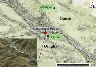
Landslide deformation monitoring is crucial for early warning and disaster prevention. This study presents a comprehensive landslide monitoring approach using global navigation satellite systems (GNSS) and automated inclinometers through a case study in Qinghai, China. Numerical modeling utilizing smoothed particle hydrodynamics (SPH) predicted potential hazards from dynamic landslide movements. The results demonstrate that the combination of GNSS and automated inclinometer systems provides accurate and real-time data on landslide movements, enabling timely responses to mitigate the risks associated with landslides. Monitoring results demonstrate active deformation of Zone III with sliding velocities up to 2.5 mm/day and deep subsurface displacement along bedrock shear planes at 14–26 m depths. SPH simulations predict a maximum run out of 115 m over 50 s for potential slope failure under a Ms 7.0 earthquake, with debris flows capable of blocking the river channel and inducing secondary hazards. Additionally, the numerical modeling using SPH provides useful insights into the potential hazard of landslides, which can be used to develop more effective mitigation strategies in the future. The findings of this study contribute to the development of a more holistic and effective approach to landslide monitoring and management.


 京公网安备 11010802027423号