Environmental Earth Sciences ( IF 2.8 ) Pub Date : 2024-03-14 , DOI: 10.1007/s12665-024-11472-x Rukaiya Kausher , Rambabu Singh , Anand Kr. Sinha
|
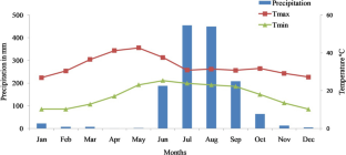
The research was employed to simulate the watershed's hydrologic behavior and to predict stream flow in the Mahan River catchment area alongside the effect of six underground (UG) and opencast (OC) mines for the past decades. Following the SWAT model run, the mining area sub-watersheds possess (SW20, SW26, SW28, SW31 and SW38) a comparatively lesser sediment yield of 61.41 Metric Ton/ha than that of non-mining area sub-watersheds 159.40 Metric Ton/ha. Amongst all hydrological components, evapotranspiration with 531.2 mm consumed 39% of the total annual precipitation (1365.3 mm). The total discharge was estimated to be 775.57 mm, which comprises Surface Runoff of about 351.89 mm, Return Flow (402.21 mm) and Lateral flow (21.47 mm), while percolation into the unconfined and confined aquifers as soil and groundwater storage also accounted for 58.86 mm. The statistical indicators and graphs indicate that the model performs satisfactorily for the daily streamflow (R2 = 0.875, p = 0.71, r = 0.76 and NSE = 0.87 during the validation (R2 = 0.817) as that during the calibration period. The model performed satisfactorily during the simulation and the results showed that the mines play a critical role in changing the hydrological regime of the watershed with low recharge and moderate evapotranspiration characteristics. Taken together, the SWAT model appears to be a reliable tool for forecasting stream discharge over long periods of time, in parallel with the likely impacts of mining activity on HRUs.
中文翻译:
印度中部马汉河流域煤矿省使用 SWAT 模型进行水文建模和水平衡成分模拟
该研究用于模拟流域的水文行为并预测马汉河流域的水流以及过去几十年来六个地下 (UG) 和露天 (OC) 矿井的影响。根据 SWAT 模型运行结果,矿区子流域(SW20、SW26、SW28、SW31 和 SW38)的产沙量相对较少,为 61.41 吨/公顷,而非矿区子流域的产沙量为 159.40 吨/公顷。 。在所有水文成分中,蒸散量为531.2毫米,消耗了年降水总量(1365.3毫米)的39%。总流量估计为 775.57 毫米,其中地表径流约 351.89 毫米,回流(402.21 毫米)和侧流(21.47 毫米),而渗入非承压和承压含水层的土壤和地下水储存也占 58.86 毫米。毫米。 统计指标和图表表明,该模型在验证期间(R 2 = 0.817)对于日流量(R 2 = 0.875,p = 0.71,r = 0.76 和 NSE = 0.87)与校准 期间的 表现令人满意 。模拟过程中表现令人满意,结果表明,水雷在改变流域水文状况方面发挥着关键作用,具有低补给和中等蒸散特征。总而言之,SWAT模型似乎是预测长期河流流量的可靠工具。时间段内,与采矿活动对 HRU 可能产生的影响同时进行。


 京公网安备 11010802027423号