Journal of the Indian Society of Remote Sensing ( IF 2.5 ) Pub Date : 2024-03-21 , DOI: 10.1007/s12524-024-01840-2 R. Srinivasan , Sunil P. Maske , K. V. Archana , V. Ramamurthy , B. P. Bhaskar
|
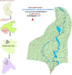
The distribution of rainfall may be adequate or inadequately affected by climate change in the arid and semi-arid regions of India. Excess rainfall in a dry region and undulating topography cause more soil erosion and crop loss in a particular year. The current study used the Revised Universal Soil Loss Equation (RUSLE) in heavy rainfall zones in conjunction with Remote Sensing (RS) and GIS to create the soil erosion map in the Almarshikeri 2 micro watershed. The RUSLE model incorporated a number of parameters for soil erosion assessment, such as soil erodibility (K), rainfall erosivity (R), slope steepness and length (LS), land use and land cover (C), and conservation measures (P). A 563 hectare watershed estimated soil loss is 114.68 tons. Assessment of soil loss in different landforms shows that average erosion is 5.92 t ha−1 from lowland and total loss from upland is 41.99 tons. Whereas, in soil types, the average range was from 4.30 to 4.79 t ha−1 and total soil losses were 46.39 tons in black soil, followed by red (32.87), brown (21.50), and problem soil (13.92). In major land use systems, soil erosion is severe in cotton and groundnut cropping system. Similarly, crop loss is higher in the lowland (23.14%) and midland (22.50%) compared with the upland (14.73%). The quantitative maximums of agricultural yield loss from groundnuts (− 54.98%), cotton (− 44.59%), ragi (− 40%), and maize (− 31.73%) are affected by heavy rains. Quantifying soil and crop loss will help adopt different soil conservation practices and crop management strategies in the watershed.
中文翻译:
印度卡纳塔克邦北部干旱地区强降雨影响的土壤侵蚀和农作物损失评估和制图
印度干旱和半干旱地区的降雨分布可能会受到气候变化的充分或不充分的影响。干旱地区过多的降雨和起伏的地形会导致特定年份更多的水土流失和农作物损失。当前的研究使用强降雨区的修订通用土壤流失方程 (RUSLE) 结合遥感 (RS) 和 GIS,创建了 Almarshikeri 2 微流域的土壤侵蚀地图。 RUSLE模型纳入了土壤侵蚀评估的许多参数,例如土壤侵蚀性(K)、降雨侵蚀力(R)、坡度和长度(LS)、土地利用和土地覆盖(C)以及保护措施(P) 。 563公顷的流域估计土壤流失量为114.68吨。对不同地貌土壤流失量的评估表明,低地平均侵蚀量为5.92 t ha -1 ,高地总流失量为41.99 t ha -1 。而在土壤类型中,黑土的平均范围为 4.30 至 4.79 t ha -1,总土壤流失量为 46.39 吨,其次是红壤(32.87 吨)、棕壤(21.50 吨)和问题土壤(13.92 吨)。在主要土地利用系统中,棉花、花生种植系统水土流失严重。同样,与高地(14.73%)相比,低地(23.14%)和中部地区(22.50%)的作物损失更高。花生(− 54.98%)、棉花(− 44.59%)、拉吉(− 40%)和玉米(− 31.73%)的农业产量损失最大数量受到大雨的影响。量化土壤和作物损失将有助于在流域采取不同的土壤保持做法和作物管理策略。


 京公网安备 11010802027423号